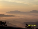
Little Blakely - Lake Ouacita
Page 1 of 1
 Little Blakely - Lake Ouacita
If your ever near Hot Springs and/or Lake Ouacita, this is a great trail system located just north of Lake Ouachita State Park. When you enter LOSP and come to the four way stop, (the welcome center sits on the left corner), make a right, towards 3-Sisters Springs, and stay on this road all the way back. You will go past the cabins, then over a wooden bridge and the road will eventually turn into gravel. I believe this is where the boundry of the National Forest begins. Stay straight on this gravel road past the ranch on your left, at the first Y, stay right (acually just straight). At the second intersection, the road comes to a dead end, and you can either only turn left or right. Make a left and this gravel road dead ends at the trail head. From the visitor center I want to say it is 6-7 miles to the trailhead, and the gravel roads are in good condition. There are lots of other trails you can explore off the main road leading to trail head (Road 302000 on the map from the link)
http://www.fs.fed.us/r8/ouachita/maps/documents/TR-26_Little_Blakely_001.pdf
There are alot of different loop combinations you can choose. All intersections are marked well. I've done the South Loop many times. The B to C section is nice, especially closer to C.
Also a good loop for mountain biking, although I haven't taken mine out, and I haven't actually seen any mountainbikers out there. It might be a little out of range of my capabilities, I'll stick to my two feet for now.
Parts are very strenous, but also very secluded and quiet, I've only seen another hiker once. It also sits inside the National Forest so camping is allowed. No official campgrounds exist but I've been thinking of doing an overnighter out here.
Be sure to sign in at the trailhead in the box, but beware of wasp nest when you open er up

mss_09- Day Hiker
- Posts : 16
Join date : 2009-04-26
Location : Hot Springs, Ar-Kansas
Page 1 of 1
Permissions in this forum:
You cannot reply to topics in this forum


» Wilderness First Aid classes
» Waterfalls Review
» Hiker's Hell!
» downloading iphone photos
» Summertime....
» LINCOLN LAKE
» My Neighbor Boy's Birthday Butterfield Hike!!