The Glory Hole
5 posters
Page 1 of 1
 The Glory Hole
I'm sure all of you have at least heard of this one, but it is without a doubt one of my favorites! When it is flowing good, there is a waterfall that goes through a hole in the top of a large rock over hang. When you go down to the underside of the fall, there is water flowing from above that is really an awesome site! The hike is pretty easy, and beautiful the whole way. And the unique waterfall at the end is well worth the work. If you haven't been there, I highly suggest you give it a go! I'll post pics and directions soon, but if you have Tim Ernst's waterfall book, its in there.
 Pics of Glory Hole Falls


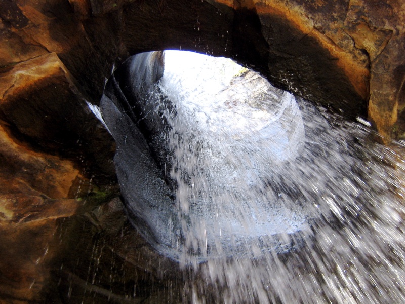
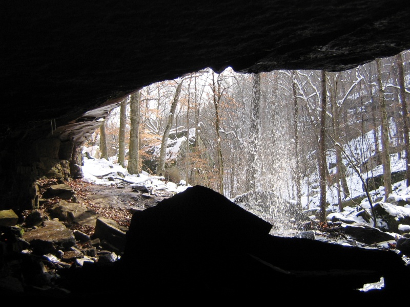
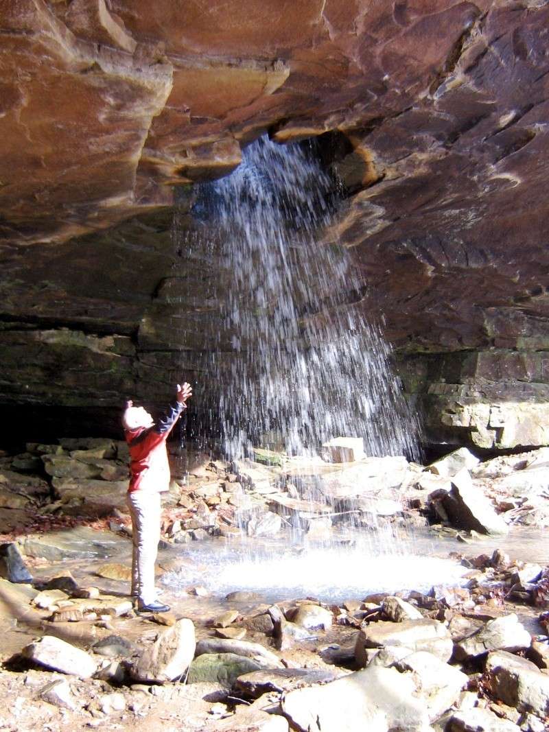
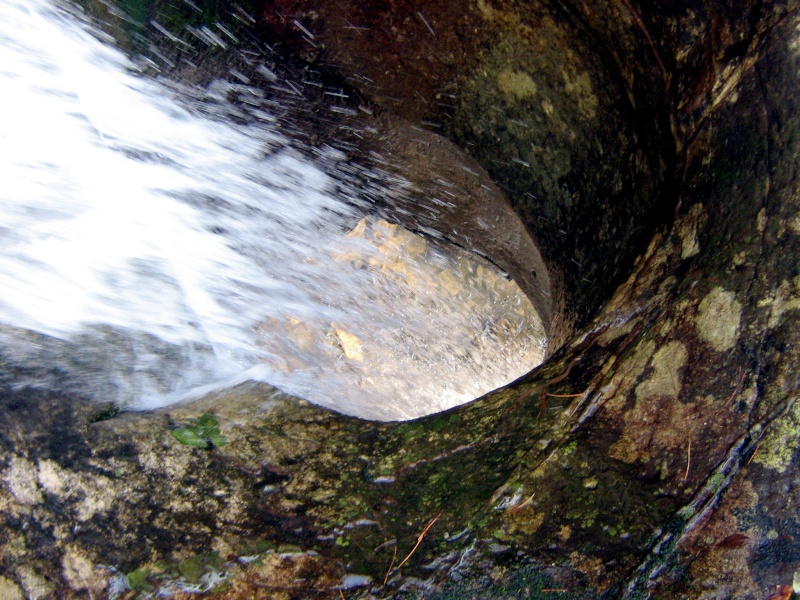
The first pic is looking up at the water coming through the hole in the roof of this over hang. The second is from the back of the "cave" that the waterfall falls into. The third one is me being goofy standing next to the fall, and the last is a pic from above the fall looking at the hole the water pours into.
 Re: The Glory Hole
Those are the best pictures of the Glory Hole I've ever seen!!!! When did you take them?
David Holthus- Happy Camper
- Posts : 42
Join date : 2008-04-01
Age : 68
Location : LITTLE ROCK ARKANSAS
 Not Sure Exactly
I took them about three or four days after all of that snow fell earlier this year (I don't know the exact date). All I can tell you is there was a lot of snow melting and the fall was flowing pretty good.
 Re: The Glory Hole
I would be hard pressed to be able to tell you where it is without Tim Ernst's waterfall book in front of me. I'll look tonight and let you know soon.
By the way, Welcome to the site!
By the way, Welcome to the site!
 Re: The Glory Hole
Check out Tim's Journal entry for January 10th. Some great photos of Glory Hole frozen.
 Re: The Glory Hole
The wetter the better. Have been down twice and the second I only thought would have more water than our first trip. Still a wonderful spot. There is lots of runoff in these pics and this is a small watershed. If you go in dryer times it is not as much flow. Snow melt or after a substantial rain would be good.
Lots of other great spots in the area. I abandoned the search for this trailhead twice also pre gps days. Not sure if I was in the right place. Easy to follow road all the way down. I have been told that bushwacking on past is worth the effort also with some excellent canyon and waterfalls on the right coming into the valley on the way down. On our list to check that out and to see it again on a wet day.
I said it looked like someone had drilled a hole through the rock. My son says, "I think God stuck his finger through it." He was right.
from the geocache site;
Take Hwy 16/21 east out of Fallsville for
5.7 miles. You will pass a red barn on the left that has a large
white "E" on the side of it. Go 1/2 mile past the barn and pull
over and park ( N 35 49.708 W093 23.426 ) across the road from the
house that is up on the hill on the left. This pull-off is also 2.3
miles west of the 16/21 junction at Edwards Junction. The walk
begins as a jeep road that heads downhill into the woods and to the
left. This road is not marked or signed. About a 1/3 of a mile down
the road, there is a standard forest service bulletin board at a
spot where the road forks ( N 35 49.486 W093 23.289 ). Take the
road to the right and it will eventually cross the creek that makes
the Glory Hole. The road turns into a foot trail that runs on the
right side of the creek. Near the Glory Hole is a wet, fragile
glade. (Please try to go around the glade to avoid damaging
it.)

Clif- Trail Guide
- Posts : 256
Join date : 2009-01-15
Location : Bee Branch suburbs
Page 1 of 1
Permissions in this forum:
You cannot reply to topics in this forum


» Wilderness First Aid classes
» Waterfalls Review
» Hiker's Hell!
» downloading iphone photos
» Summertime....
» LINCOLN LAKE
» My Neighbor Boy's Birthday Butterfield Hike!!